I recently started using Downlink on my Mac and I have not been this delighted with a piece of software in quite some time!
To give you an idea, every morning when I come into the office I turn on my computer and I see something like this:
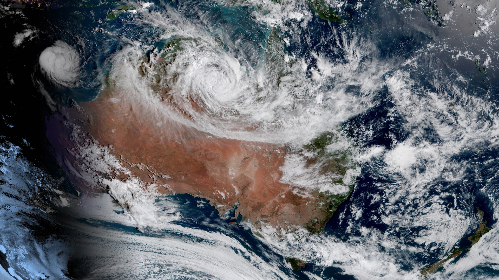
I mean, what a view!
Things I Particularly Enjoy
1. Cloud Shadows
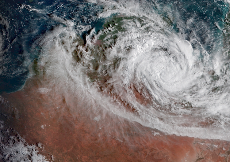
You only really see this at the very edges of the sunlight around dawn or dusk, because for the shadow of the cloud to be seen, it has to be very far from the cloud sideways (otherwise it’s hidden behing the cloud compared to the satellite). It also helps if the clouds are high altitude.
Why do I like it?
I think it’s because it gives me a really intuitive feeling for the fact that there is a real 3 dimensional planet down there, and on top of it there’s this swirling layer of gas that is moving all the time. It’s as if I have the earth in front of me on a lab bench. Granted I can’t do experiments on it, but much like a kid with an aquarium I’m happy to just watch 🤓
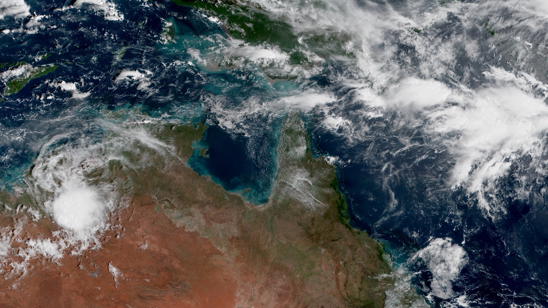
2. The way the ocean looks in the top end of Australia.
In a way, the reason I made this post was purely so I could have somewhere to post all the beautiful things I see on these images, and seeing that huge sprawling turquoise ocean surrounding the deep greens and reds of northern Australia just makes my heart leap. Our planet is really quite something!
Something I don’t enjoy but still find the images valuable for: Bushfires
There have been a few instances where having live high resolution satellite images has been helpful in a more practical sense, and never more so that with the bushfires in Australia this year.
In the media there were maps of Australia showing half of the continent on fire. What was really going on?
Well, have a look for yourself:
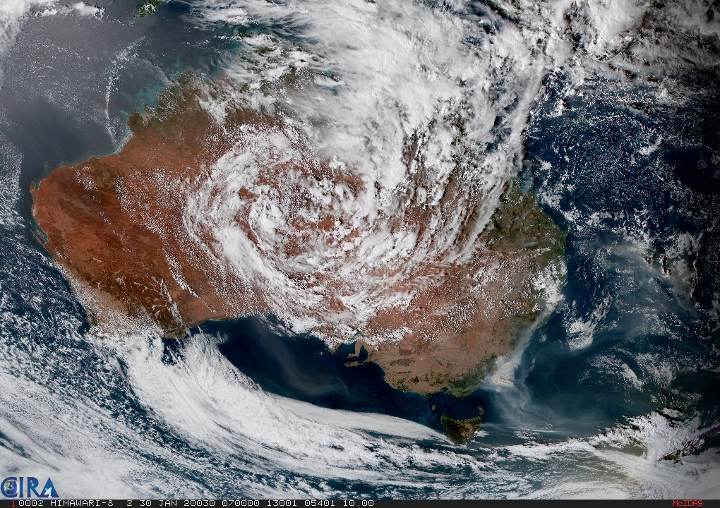
It’s getting to the point now where most of the images of the really bad bushfire days are being removed from the archive (they only keep 4 weeks), but the value of being able to see what they looked like live was purely the fact that I could put things that I was hearing at the time into perspective. The press have stopped talking about it now and the bushfires are a lot less intense. At the very least I can’t spot them from the satellite pictures anymore.
Information like this - Straight from an objective source, undoctored and without spin - is the kind of thing I find really helpful to ground me in times when the press gets carried away with spinning their yarn.
Notes
Images used by Downlink and by me for this post come from the Colorado State University’s site. They have lots of different images from Himawari 8 (the satellite where I got the above pictures) but also images from other earth observation satellites!
The Full Disk Geocolor section produces the most natural looking images (like the ones I used here) but the satellites are capable of quite a lot more useful things than just making pretty pictures so go have a look around if you’re curious 🤓
🐒